
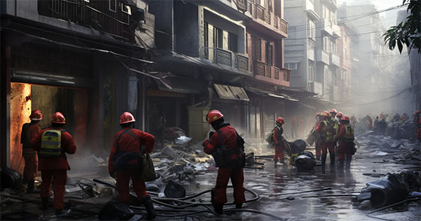
Post Disaster Mapping
Spatio Logic offers advanced post-disaster analysis services using cutting-edge geospatial technologies. Leveraging satellite imagery, AI-powered analytics, and remote sensing techniques.
Spatio Logic provides detailed assessments of disaster impacts, including damage mapping, change detection, and risk evaluation. It specializes in rapid mapping of affected areas, identifying infrastructure damage, monitoring ground deformation, and supporting emergency response planning. Machine learning and AI are used to automatically classify damaged areas, detect patterns of destruction, predict high-risk zones, and analyze large datasets quickly and accurately. These intelligent systems enable faster decision-making, helping governments and organizations to efficiently manage relief operations, resource allocation, and long-term recovery.
Spatio Logic ensures timely delivery of results by automating workflows and utilizing near real-time satellite data, allowing critical information to be provided as soon as possible after a disaster strikes.
Examples
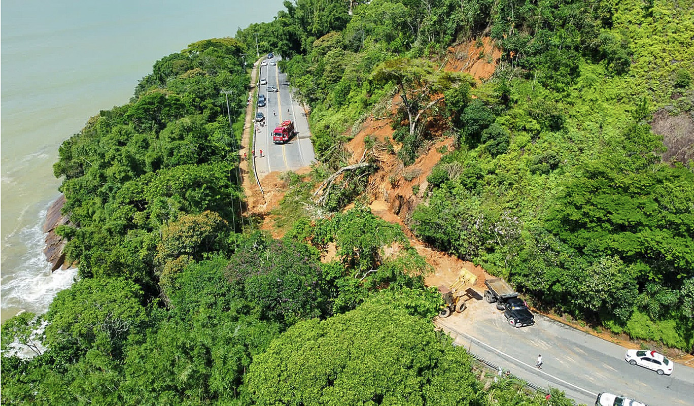
Landslides
Landslides are the movement of rock, soil, or debris down a slope, caused by factors like heavy rainfall, earthquakes, or human activities. They can occur suddenly or gradually, leading to significant damage in vulnerable hilly or mountainous regions.
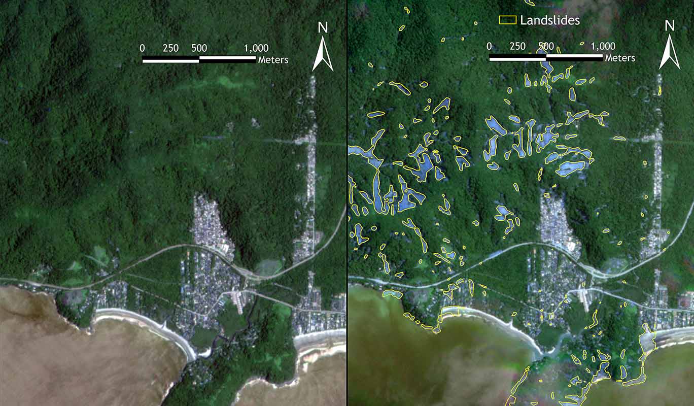
BeforeAfter
Landslide disaster
Sao Sebastiao Brazil 2023
Following the catastrophic landslides in São Sebastião, Brazil, in 2023, Spatio AI applied advanced Artificial Intelligence and Machine Learning (AI/ML) techniques to accurately detect and map landslide-affected areas using high-resolution optical satellite imagery. Our AI-powered detection system enabled rapid identification of impacted zones, providing critical geospatial insights to support emergency response, damage assessment, and long-term risk reduction strategies.
This project demonstrates the power of geospatial AI in delivering scalable, reliable, and timely solutions for disaster monitoring in complex terrains.
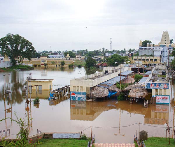
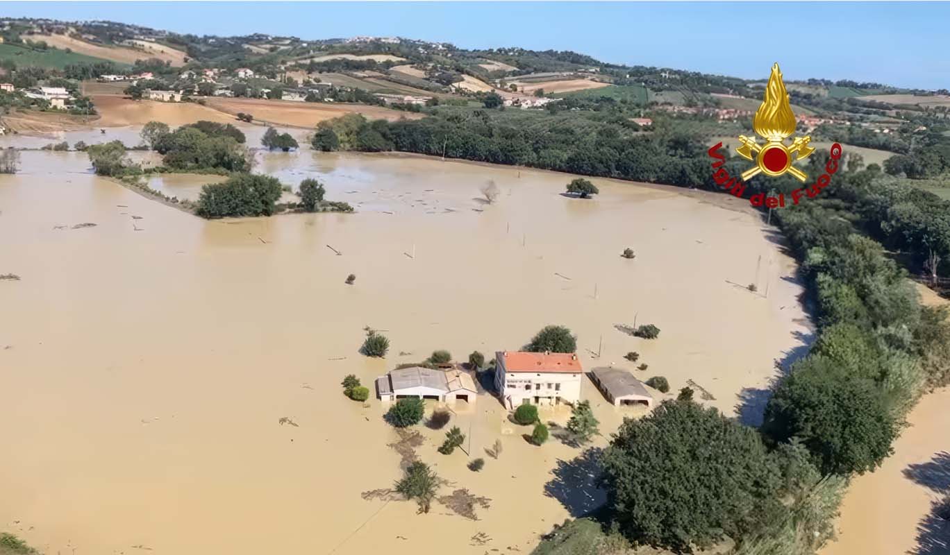
Flood
Floods are the overflow of water onto normally dry land, caused by natural or human-induced factors such as intense rainfall, river overflow, dam failure, or rapid snowmelt. Floods can develop gradually, as in river floods, or suddenly, as in flash floods, leading to widespread damage to life, property, agriculture, and infrastructure in affected areas.
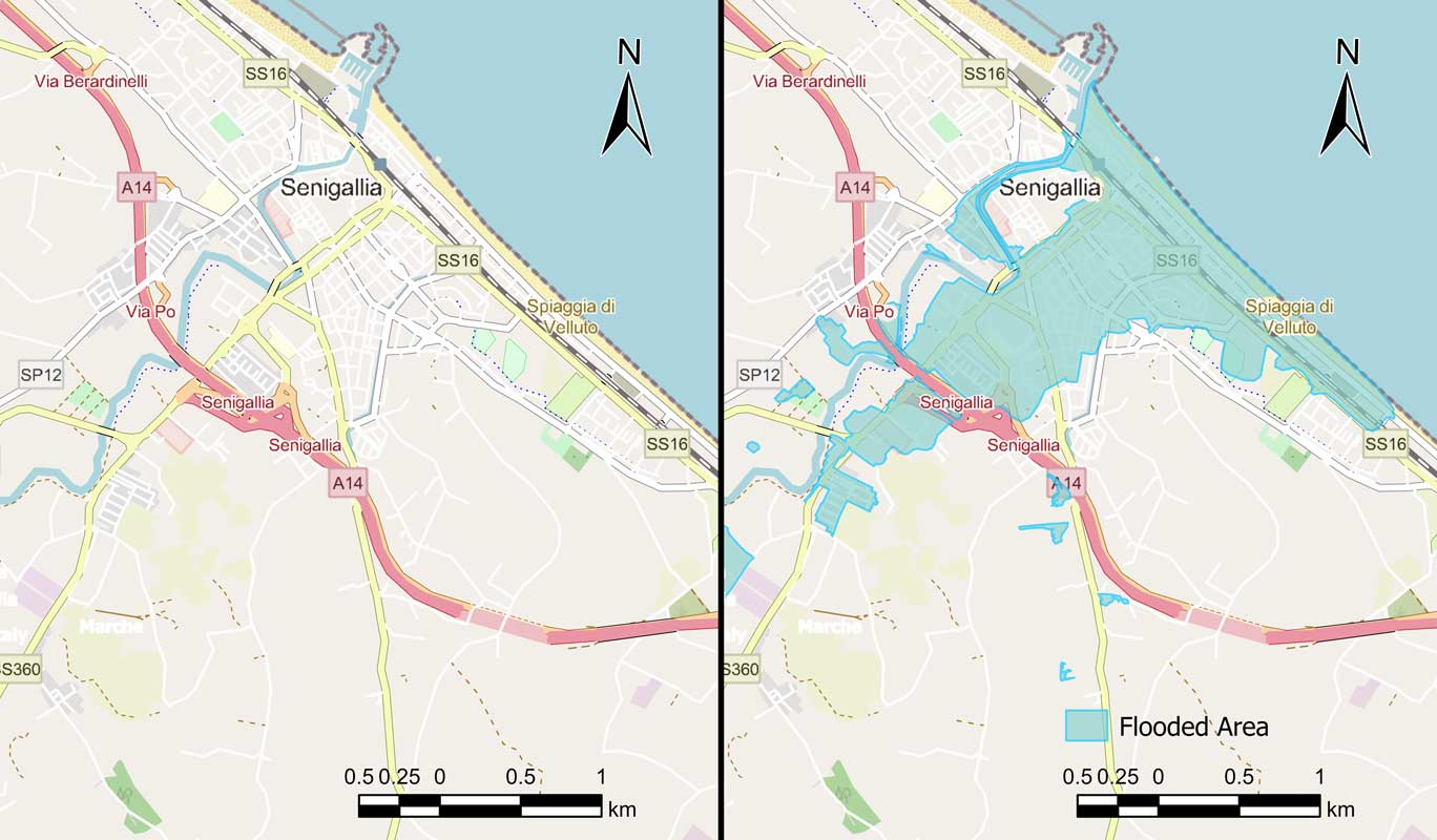
BeforeAfter
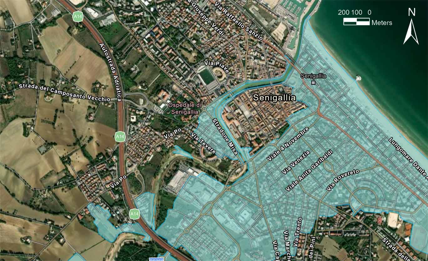
Senegallia Italy flood disaster 2022
The Senigallia flood disaster of 2022 occurred in the coastal town of Senigallia, Italy, and was caused by intense rainfall that led to the overflow of the Misa River. The heavy rains in early May triggered flash floods, submerging large parts of the town, including residential and commercial areas. The flooding resulted in significant damage to infrastructure, property, and transportation networks, with widespread disruption to daily life.
The before-and-after maps highlight the extent of inundation, showing how urban areas were affected, particularly near the river and coastline. This event emphasizes the importance of early warning systems, flood risk assessment, and better urban planning to reduce the impact of such disasters in the future.